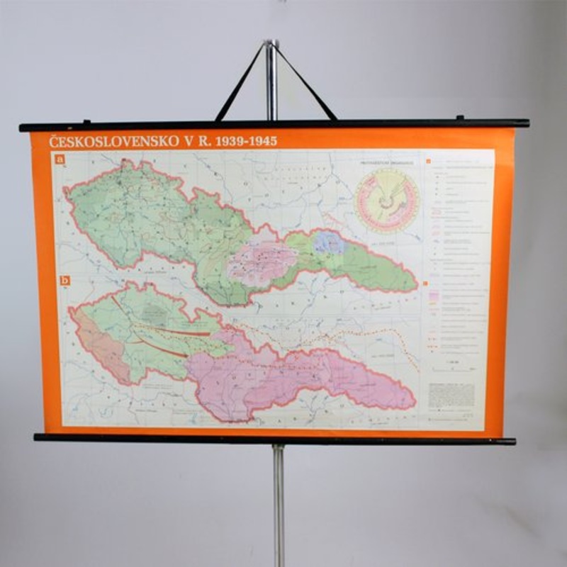
This is a great vintage school map of Czechoslovakia in 1939 - 1945. The map was produced by a National company Skolske Pomocky (School accessories) in 1960s in Czechoslovakia. This map was originally used in schoold to describe the borders of the union of
This is a great vintage school map of Czechoslovakia in 1939 – 1945. The map was produced by a National company Skolske Pomocky (School accessories) in 1960s in Czechoslovakia. This map was originally used in schoold to describe the borders of the union of Czechoslovakia to elementary school students. It is made of paper on plastic with black wooden slats on bottom and top. Hangs on an original black twine. Very good condition without tears or damages. Only minor age patina. Great wall decoration for any interiors.
| Design Period | 1960 to 1969 |
|---|---|
| Year | |
| Production Period | 1960 to 1969 |
| Country of Manufacture | Czech Republic |
| Style | Vintage, Mid-Century, Industrial, Postmodern |
| Detailed Condition |
Very Good This vintage/antique item has no defects, but it may show slight traces of use. |
| Restoration and Damage Details |
Patina consistent with age and use
|
| Product Code | UL-882489 |
| Materials | Paper, Plastic, Wood |
| Color | Black, multicolored |
| Width |
124 cm 48.8 inch |
| Depth |
2 cm 0.8 inch |
| Height |
83 cm 32.7 inch |
| Duties Notice | Import duty is not included in the prices you see online. You may have to pay import duties upon receipt of your order. |

Copyright © 2026 .All Rights Reserved.Powered by www.beautifyhomeb.com


Reviews
There are no reviews yet.